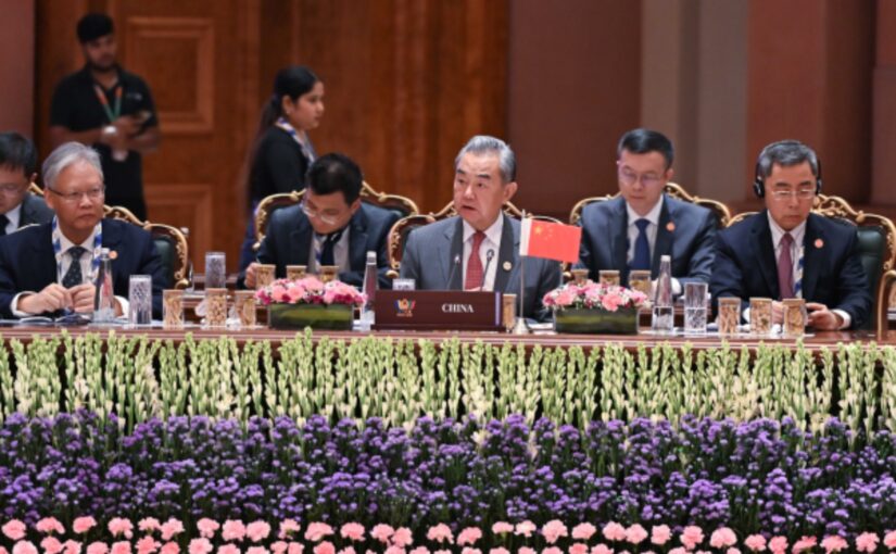
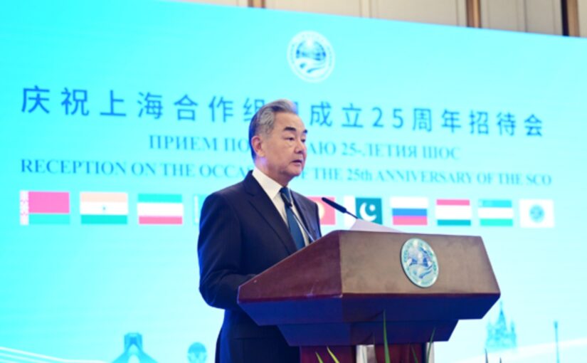
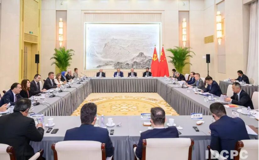
A meeting of BRICS National Security Advisers was held in the Indian capital New Delhi on June 23. Chinese Foreign Minister Wang Yi attended in his capacities of Member of the Political Bureau of the Communist Party of China (CPC) Central Committee and Director of the Office of the Central Commission for Foreign Affairs.
The meeting was chaired by India’s National Security Adviser Ajit Doval and the attendees held in-depth exchanges of views on issues including response to non-traditional security challenges, counter-terrorism and cybersecurity.
Wang Yi said at the meeting that BRICS cooperation has gone through 20 years and has increasingly become a core force in the world that safeguards peace, promotes development and upholds justice. Facing the complex and profound changes in the current international landscape, China is willing to work with other BRICS countries to jointly address the urgent challenges facing human society and jointly adhere to the right direction of world history evolution.
In this regard he put forward four key points which included:
Uphold the international order with BRICS responsibilities. “We must hold high the banner of multilateralism, firmly safeguard the purposes and principles of the UN Charter, and unequivocally oppose unilateralism and protectionism. As the forefront of the Global South, BRICS countries should take the lead in speaking out for justice and acting fairly and enhance their status and role in international affairs.”
Respond to global challenges with BRICS actions. “We must resolutely combat all forms of terrorism, unequivocally oppose the militarisation of outer space, effectively address global energy and food security challenges, strengthen cooperation on strategic mineral resources, and unite to respond to the Ebola epidemic in Africa.”
Wang Yi stressed that the vitality of BRICS lies in equality and mutual benefit and the strength of BRICS lies in unity and mutual assistance.
Summarising the outcomes and significance of the meeting, Wang Yi said that “the common message sent by this meeting is that BRICS and the Global South should uphold independence, strengthen solidarity and mutual assistance, pool more collective wisdom, and coordinate stronger joint actions. The clear direction set by this meeting is that we support further leveraging the mechanism of the Meeting of BRICS National Security Advisors and High Representatives on National Security, maintaining communication and coordination on major international and regional hotspot issues, and continuously enriching the dimensions of greater BRICS cooperation.”
Next year China will assume the BRICS chairmanship and Wang said that he looks forward to gathering with everyone again in China.
Wang also referred to lessons to be drawn from the US-Iran war, noting that the United States and Iran have recently reached a first-phase memorandum of understanding. “The conflict, which lasted over a hundred days, has sharply affected the regional and international situation and offers us profound lessons”:
The importance of upholding international rules. The settlement of any international and regional hotspot issues should be based on abiding by international rules. The law of the jungle may succeed for a while, but it is not sustainable.
The importance of respecting national sovereignty. Territorial integrity shall not be violated and a country’s internal affairs shall not be interfered with.
The importance of establishing a new vision of security. Countries are increasingly becoming a community of a shared future and the practice of seeking absolute security of oneself at the expense of others will only backfire.
The importance of understanding the new forms of warfare.
On the issue of strengthening BRICS cooperation on counter-terrorism and cybersecurity, Wang said that, at present, the world is witnessing a new wave of international terrorist activities. The root cause of this is the intensifying confrontation caused by unilateral actions and the increase in inter-civilisation and inter-religion tensions.
BRICS countries should jointly safeguard international rules in cyberspace, oppose the deliberate creation of division and confrontation, promote the signing and ratification of the United Nations Convention against Cybercrime by all countries as soon as possible, and actively participate in the international alliance against telecom cyber fraud.
Indian Prime Minister Narendra Modi met with the delegates on the same day.
Speaking with Wang, Modi noted that both India and China are ancient civilisations with a history of friendly exchanges spanning several millennia, and for a long period the two countries held leading and influential positions in the world. Under the current circumstances, it is necessary for the two sides to carry forward their traditional friendship, maintain high-level exchanges, advance practical cooperation, and safeguard the common interests of Global South countries. The Indian side supports China in assuming the BRICS chairmanship next year and is ready to work with China to advance the BRICS cause.
Wang said that as the two largest developing countries and important members of the Global South, China and India should play an exemplary role in promoting unity and self-reliance among Global South countries. China will continue to support India in fulfilling its responsibilities as the rotating chair of the BRICS and work together to promote deeper and more substantive progress in BRICS cooperation.
The previous day, he met with Indian National Security Advisor Ajit Doval.
Wang said that under the joint guidance of President Xi Jinping and Prime Minister Narendra Modi, China-India relations have gradually emerged from the low ebb and returned to the track of recovery and improvement. The two leaders agreed that China and India are partners, not rivals, which constitutes the most important strategic consensus between the two sides and provides strong impetus and strategic guarantee for the sound and steady growth of bilateral relations. As the world’s two most populous economies, China and India should not only view bilateral relations with a long-term perspective but also advance bilateral cooperation with a global vision. At present, the Global South, including China and India, is experiencing a collective rise. As the first echelon of the Global South, BRICS should actively champion and advance the process toward multipolarity, safeguard the legitimate rights and interests of developing countries, and work for a more just and equitable international order.
Thanks to the joint efforts of both sides, exchanges in various fields have gradually resumed, communication and cooperation are progressing in an orderly manner, and the border areas have remained generally peaceful. These outcomes are hard-won and should be doubly cherished. It is important to respect each other’s core interests, properly handle sensitive issues, and keep the China-India boundary question at an appropriate place in bilateral relations so as to prevent it from affecting the overall relationship.
Ajit Doval noted that through their meetings in Kazan and Tianjin, the leaders of India and China have charted the course for the development of bilateral relations, and agreed that India and China are partners, not rivals. They believe that a stable India-China relationship serves the common interests of both sides. India is ready to continue to view its relations with China from a strategic perspective, work with China to implement the common understandings of the two leaders, take a forward-looking approach in viewing and accelerating the development of bilateral relations, properly handle differences, and strive for win-win outcomes. India is one of the first countries to recognise the People’s Republic of China, and its position on the Taiwan question remains unchanged.
On June 23, Wang Yi met with Secretary of the Russian Federation Security Council Sergei Shoigu.
Wang Yi noted that Russian President Vladimir Putin paid a successful state visit to China in May, during which the two heads of state had in-depth strategic communications. The two sides issued two joint statements: one sets out strategic plans and provides strong impetus for the China-Russia Comprehensive Strategic Partnership of Coordination for the New Era; the other points out the future direction for the development of human society and clarifies the prospect of a multipolar world.
Sergei Shoigu said that facing the profound changes unseen in a century, Russia and China should deepen mutual trust, carry out close cooperation, jointly resist all kinds of interference and infiltration by external forces in the security field, and oppose Japan’s attempts at remilitarisation.
Meeting with Secretary General of the Egyptian National Security Council Youssef Alaa El-Deen on June 22, Wang Yi noted that this year marks the 70th anniversary of the establishment of diplomatic ties between China and Egypt, an important milestone for the bilateral relationship to carry forward past achievements and forge ahead into the future. He stated that the international landscape is undergoing profound and complex shifts. As important members of the Global South, China and Egypt share extensive common ground on international and regional affairs and shoulder important responsibilities for safeguarding global and regional stability. China is willing to step up coordination and collaboration with Egypt on multilateral platforms including the BRICS and the United Nations, jointly uphold the independence and self-reliance of the Global South and promote its unity and self-strengthening, actively advance the multipolarisation process, and work together to build a community with a shared future for humanity.
Youssef Alaa El-Deen said that centering on the 70th anniversary of diplomatic relations, Egypt will boost high-level exchanges and deepen practical cooperation under frameworks such as the Belt and Road Initiative, the BRICS mechanism and the Forum on China-Africa Cooperation (FOCAC) to deliver greater progress to bilateral ties.
The two sides also exchanged views on the Middle East situation. Youssef Alaa El-Deen briefed Wang Yi on the latest developments and mediation efforts by the Quartet including Egypt and spoke highly of China’s vital role in stopping the fighting and promoting peace. [Besides Egypt, the recently established ‘Regional Quartet’ includes Pakistan, Saudi Arabia and Türkiye.]
Wang said that the memorandum of understanding signed between the United States and Iran, which commits both sides to respect each other’s sovereignty and territorial integrity, refrain from launching any military operations and avoid interfering in each other’s internal affairs, sends a positive signal to the world and should be jointly upheld and implemented. The negotiation process can hardly be smooth and may face various disruptions and even setbacks. Yet now that the door to peace has been opened, it must not be closed again.
The next day, Wang met with Secretary-General of the Supreme National Security Council of the United Arab Emirates (UAE) Ali Mohammed Hammad Al Shamsi.
Wang said that the US-Israeli war against Iran should never have happened and should be brought to an end as soon as possible. Recently the conflict has finally turned toward dialogue, but whether genuine peace can be achieved still requires the joint efforts of all parties. At the current stage, priority should be given to three things:
Uphold a permanent and comprehensive ceasefire and effectively implement the memorandum of understanding just signed.
Resume normal navigation through the Strait of Hormuz as soon as possible.
Draw lessons from the repeated turmoil in the Middle East, rebuild mutual trust among regional countries, and explore a new regional security architecture suited to the evolving situation.
Continue reading Wang Yi in New Delhi: BRICS should take the lead in speaking out for justice